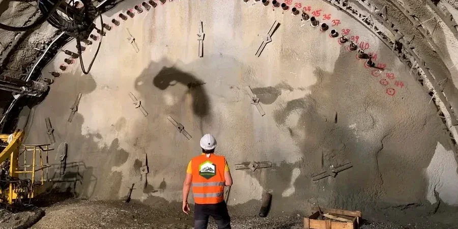
A cut on the hilltop of North Tacoma behaves nothing like a dig down in the Port tide flats. Up in the Proctor District you're likely trimming into dense glacial till; down by the Thea Foss Waterway the ground shifts from loose fill to soft estuarine clay within a few feet. That contrast is exactly why we treat every excavation monitoring program as a custom deployment, not a checklist. When your shoring wall is holding back a 25-foot cut and the neighbor's foundation is fifteen feet away, the only thing that keeps the permit moving is reliable instrumentation readout. We cover Tacoma's South Sound basin, where the combination of seismic risk and groundwater fed by Commencement Bay demands a level of vigilance that goes beyond basic crack gauges. A well-instrumented deep excavation project starts with knowing which zones will creep under load and which will drain fast enough to stabilize on their own.
In Tacoma's tide flats, a piezometer that flatlines for two days is often more alarming than one that shows steady drift.
Service characteristics in Tacoma
Critical ground factors in Tacoma
Something we see repeatedly in Tacoma is that contractors assume the stiff till at the curb line extends all the way to the back of the cut, when in reality there's a lens of saturated outwash sand hiding behind it. The moment the excavator breaks through that lens, the piezometer spikes and the inclinometer shows a kick of 0.2 inches overnight. Without continuous monitoring, that movement gets discovered when the sidewalk cracks open. We've also learned not to trust the tide flat soils to drain on their own; the silt layers retard consolidation so much that a shoring design that works in Seattle's advance till can rack up twice the deflection down here. So we set yellow-alert thresholds at 50% of the IBC 3304 allowable, not 80%, and we call the engineer the same hour the trend curve tilts upward. In a city where the Cascadia Subduction Zone is a real design consideration, no excavation monitoring plan is complete without a post-earthquake rapid-assessment protocol tied to the inclinometer baselines.
Our services
Our Tacoma monitoring deployments combine geotechnical instrumentation with practical site logistics so you get actionable data, not raw CSV files. Each program is reviewed by a licensed geotechnical engineer familiar with Pierce County permitting.
Real-Time Excavation Monitoring Package
Fully automated biaxial inclinometers, vibrating-wire piezometers, and optical survey points with cloud dashboard. Includes 15-minute logging during active cut phases, daily trend reports, and phone alerts when threshold curves are approached.
Adjacent Structure Baseline Survey
Pre-construction condition survey with crack gauges, digital level settlement monuments, and vibration monitoring. We document existing defects, set trigger levels per IBC 3304, and provide weekly comparison reports during shoring and dewatering.
Quick answers
What's the cost range for excavation monitoring on a typical Tacoma infill project?
For a single-shoring-face cut with two inclinometer stations, three piezometers, and monthly manual surveys over a 60-day excavation window, the work typically falls between US$930 and US$2,520 per month of active monitoring. The spread depends on whether you need automated data loggers with cellular telemetry or can rely on weekly manual readings.
Which instruments are required by Tacoma's building department for deep excavations?
Tacoma follows IBC 2021 Section 3304 and typically requires inclinometers on shoring walls deeper than 12 feet, settlement monitoring on adjacent structures within a 45-degree influence zone, and groundwater observation wells when dewatering is active. The geotechnical engineer of record sets the specific instrument types and threshold values in the shoring submittal.
How fast can you deploy inclinometers once the shoring permit is issued?
We can typically have inclinometer casings installed and read within three working days of notice, assuming the drill rig has access. The piezometers go in the same shift if we're using the same borehole. Automated telemetry takes an extra day to configure and test the cellular gateway.
What do you do if the inclinometer shows deflection above the trigger level?
We call the engineer of record immediately, not after the weekend. Our protocol is to increase the read frequency to continuous, check the adjacent settlement points for correlation, and if movement is accelerating, recommend a pause in excavation until the shoring design is re-evaluated. In Tacoma's tide-influenced soils, we've seen false triggers from tidal pressure shifts, so we always cross-check with piezometric data before sounding the alarm.