Tacoma's geology tells a complicated story. Glacial outwash from the last ice age left deposits of sand and gravel across the Port of Tacoma area, while the Puyallup River delta introduced layers of soft silt and clay in the Foss Waterway. You cannot guess the grain size distribution by looking at a sample. A proper sieve and hydrometer analysis separates the fine fraction from the coarse, giving the lab team the exact percentages needed to classify the soil under ASTM D2487. We run the full procedure from wash sieve to hydrometer reading, and when the project involves deep excavations near the tide flats, we often pair this with a CPT test to verify the stratigraphy and drainage behavior without waiting for lab turnaround on every interval.
Without the hydrometer, that 22 percent clay fraction stays invisible — and your drainage design is guessing.
Service characteristics in Tacoma
Critical ground factors in Tacoma
Tacoma sits at roughly 240 feet above sea level, but the real geotechnical concern is the loose alluvium and fill along the Thea Foss and Blair waterways. A misclassified soil in these areas — calling a clayey silt a sandy silt — can lead to underestimated settlement, poor compaction control, or slope instability during the rainy months when precipitation averages over 39 inches a year. The grain size curve is the first line of defense. If the fines content exceeds 15 percent, the hydrometer step is not optional; it is required to assess frost susceptibility, drainage, and liquefaction potential under the IBC seismic provisions that govern construction in Pierce County. Skipping the full analysis on a silty fill means accepting a risk that the foundation drain clogs and the slab heaves after the first winter.
Our services
Our Tacoma lab handles the full geotechnical testing sequence from sample receiving through final report. We focus on three core methods that support local foundation and earthwork design.
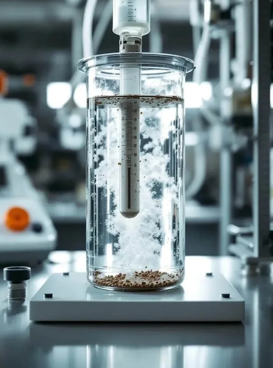
Full Sieve + Hydrometer Package
Complete particle size distribution from coarse gravel to colloidal clay. Includes wash sieve, oven drying, mechanical shaking, and 24-hour hydrometer sedimentation. Report delivers gradation table, curve, Cu, Cc, and USCS classification.
Sieve-Only Analysis
For clean sands and gravels with negligible fines. We run a mechanical shaker through a full column of ASTM E11 sieves, report percent retained and passing per sieve, and provide a gradation chart suitable for filter design and concrete aggregate evaluation.
Atterberg Limits Add-On
When the hydrometer shows significant clay fraction, we run liquid limit and plastic limit per ASTM D4318 on the same sample. This completes the USCS classification with the plasticity chart and gives the design team the parameters needed for slope stability and shrink-swell assessment.
Quick answers
How much does a grain size analysis cost in Tacoma?
A standard sieve with hydrometer runs between US$90 and US$170 per sample, depending on whether we need to run Atterberg limits in parallel and the number of sieves in the column. Projects with high sample volume typically qualify for reduced per-unit pricing.
How long does the hydrometer test take?
The hydrometer sedimentation phase requires a minimum of 24 hours from the start of readings to capture the fine silt and clay fraction. Combined with the sieve portion, we typically deliver the final report within 3 working days. Rush turnaround can reduce that to 2 days.
Do you need a hydrometer if the soil looks clean?
Visual inspection can be deceiving. We have seen Tacoma glacial outwash samples that appeared clean in the field but carried 8 to 12 percent fines once washed over the No. 200 sieve. The hydrometer confirms whether those fines are silt or clay, which matters for drainage and frost design. Our policy is to run the full analysis unless the client explicitly waives it.
What sample size do you need for the lab?
For combined sieve and hydrometer, we need roughly 1,000 grams of dry soil for sandy materials and 500 grams for fine-grained soils. The sample must be representative of the stratum and sealed in a moisture-tight bag. We can accept disturbed samples in plastic jars or zip-lock bags; no Shelby tube is required for gradation testing.