Tacoma's subsurface tells a story shaped by the Vashon glaciation and the lahar flows that poured down from Mount Rainier roughly 5,600 years ago, leaving deposits that can shift from dense till to loose volcanic debris within a single lot. When a drilling log feels ambiguous or a retaining wall design needs a direct look at backfill material, the exploratory test pit cuts through the guesswork. Our team opens these excavations across Tacoma's neighborhoods—from the Port area to the slopes near Point Defiance—logging stratigraphy, collecting undisturbed samples, and checking groundwater seepage with the same rigor we apply in the lab. Because the city sits in Seismic Design Category D under the IBC, knowing whether you are bearing on glacial drift or undocumented fill directly affects foundation decisions. We often pair the pit observations with a CPT test to extend the profile beyond the reach of the bucket.
A test pit in Tacoma's glacial soils gives you what no borehole can: a continuous vertical face to read the depositional history directly.
Service characteristics in Tacoma
Critical ground factors in Tacoma
IBC Section 1803 requires that soil classification and allowable bearing pressures be based on adequate subsurface exploration—and in Tacoma, where the geologic map shows both Qva (Vashon advance outwash) and Qvt (Vashon till) interfingering across short distances, relying on a single boring can misrepresent the entire site. A test pit uncovers lenses of soft silt or pockets of organic material that a 4-inch auger would miss entirely. On steep lots above Commencement Bay, we have found buried construction debris from early 20th-century development—material that reports as uncontrolled fill and requires overexcavation. The exploratory test pit lets the geotechnical engineer point to a vertical exposure and say: this is what we are designing for. That level of certainty matters when you are placing footings 10 feet from a property line and the neighbor's structure dates from 1920.
Our services
Our exploratory test pit service covers the full sequence from excavation to lab report. We handle traffic control permits in Tacoma, locate underground utilities through 811 coordination, and manage spoils disposal so the contractor receives a clean, documented observation package.
Utility clearance and traffic control
811 locate coordination and Tacoma right-of-way permitting for pits in streets or alleys.
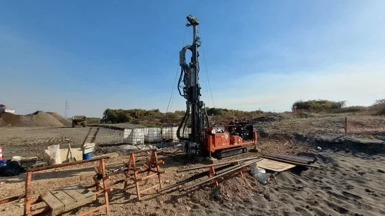
Machine-excavated test pit with geologist logging
Continuous observation during digging, stratigraphic column drafted on site, photo documentation of each layer.
In-situ testing and sampling
Density by sand cone, hand-cut block samples for shear strength, bulk bags for gradation and Atterberg limits.
Groundwater monitoring and backfill observation
24-hour stabilized level reading, seepage rate measurement, and compaction testing of backfill if required.
Quick answers
What does an exploratory test pit cost in Tacoma?
For most Tacoma projects the exploratory test pit ranges from US$440 to US$860, depending on depth, access constraints, and the number of samples collected. A shallow pit in open terrain with one bulk sample sits at the lower end; a deeper excavation requiring hydraulic shoring, multiple density tests, and traffic control in a Tacoma right-of-way reaches the upper range. The price includes 811 utility clearance, machine time, geologist logging, field density testing, and the written report with stratigraphic log and site photos.
How deep can you go with a test pit in Tacoma's soils?
With a standard backhoe we reach 14 feet in competent ground. In the dense Vashon till typical of Tacoma's uplands, the bucket handles well and sidewalls stand near-vertical. In looser advance outwash or fill we slope the walls or use a hydraulic trench box per OSHA 1926 Subpart P. If the project needs data below 14 feet, we bench the excavation and advance SPT drilling from the pit floor, giving you visual inspection of the upper zone plus penetration resistance deeper down.
When should I choose a test pit instead of a boring?
Choose a test pit when you need direct visual confirmation—identifying fill versus natural soil, locating the exact contact between geologic units, or sampling gravelly material that collapses in a borehole. In Tacoma's Port and tide flat areas, where undocumented historical fill is common, a pit lets you see the debris, measure its thickness, and decide on overexcavation limits with confidence. Borings give you continuous depth information; pits give you a vertical face to read. We often combine both methods on the same Tacoma site.